Photos courtesy of Risk Management Department, Prefectura of Bolívar Province, Emily Conrad and Rachel Conrad
UC Davis researchers bring water expertise across borders to help a region impacted by catastrophic floods.
After a catastrophic flood destroyed lives, farmland and homes in a small Ecuadorian farming community, local residents reached out to UC Davis water experts for help. Now the computer models those experts created may help the community restore their water rights and help protect them against future disasters.
Swept Away
It was raining on March 19, 2015, when Cruz Ramiro Quinatoa got a call from his daughter, Carmen Quinatoa. She lived about 15 minutes away in the small community of San Pablo de Amalí. She told him the river was rising, and she was scared. He tried calling her back many times that night, but she never answered.
The next morning, he ran down the mountain to check on her and his 8-year-old grandson, Mauricio Albuja.
“They were swept away. Three houses: two friends’ houses and the house of my daughter. She went away with the water, and I couldn’t save her,” he said, choking back tears. His grandson also died in the flood.
Overall, the floods that night along the Dulcepamba River took three lives — Carmen, Mauricio and their neighbor Glenda Cuji Pala — and destroyed 25 acres of farmland and 10 houses.
UC Davis computer models have since indicated that the flood was not a natural disaster. Only an average amount of rain fell during the 2015 flood — an amount expected every five to seven years.
The community and research suggest that the 2013 installment of an 8-megawatt, run-of-the-river hydropower plant put them at increased flood risk. Its construction by multinational corporation Hidrotambo S.A. dynamited bedrock, deforested parts of the floodplain and moved the river’s channel 400 feet closer to San Pablo de Amalí, displacing the water toward the community.
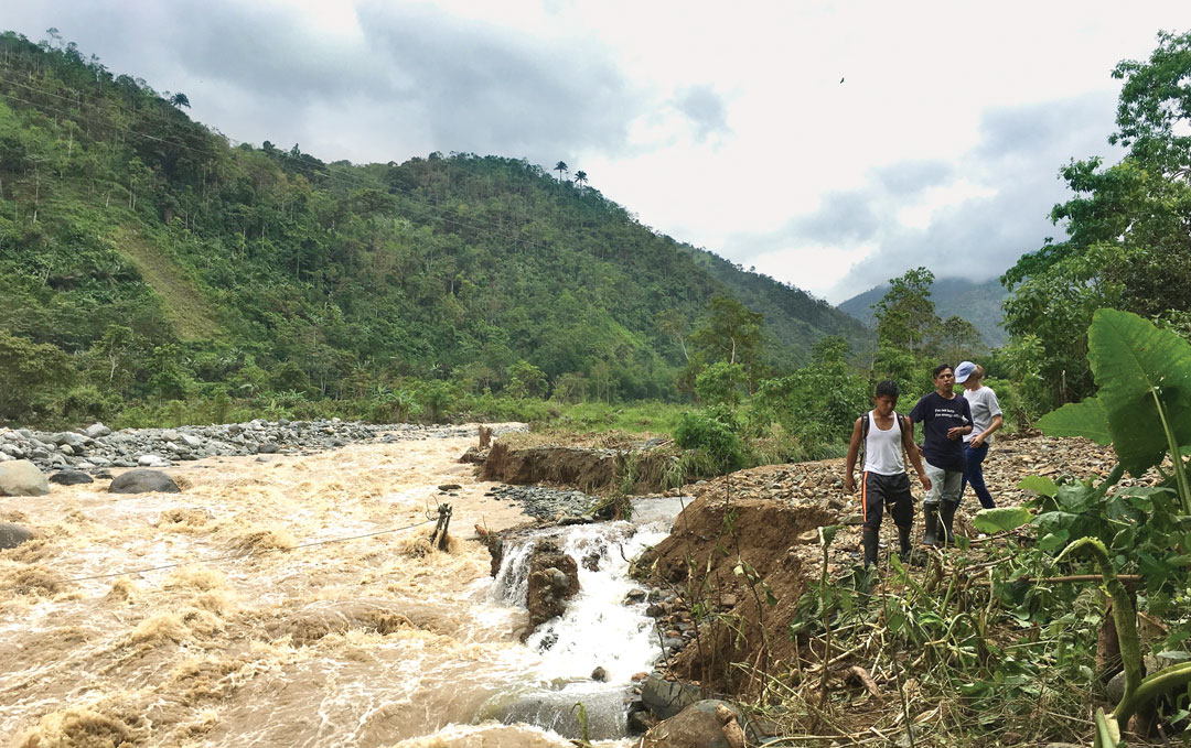
Dulcepamba Project team members Rachel Conrad, Darwin Paredes, and his son, Jairo Paredes, observe how the Dulcepamba River relocated to the only road out of San Pablo de Amalí. Downed power lines are in the rapids where the road had been.
Wes Walker
Karin Higgins / UC Davis
Overallocated
“The flood was devastating, but that was only half of it,” said Rachel Conrad, an onsite researcher leading an effort called the Dulcepamba Project who reached out to the UC Davis Center for Watershed Sciences for technical help.
The models also show that the hydropower plant had gained a legal right to more water than exists in the watershed.
Hidrotambo was allocated 69.2 cubic feet per second in the dry season and 229.5 cfs in the wet season. The company was also required to leave 37.4 cfs in the river for environmental flows.
A computer model created by Wes Walker, a UC Davis graduate student at the time, shows there is insufficient flow for the allocation, environmental flow and water needs of residents on 69 percent of the days between 2010 and 2017. This includes most summer days, when residents need it most.
This effectively stripped San Pablo de Amalí and more than 140 communities upstream of their water rights — leaving them without a legal right to use water during much of the year, while the facility’s infrastructure makes downstream residents more vulnerable to catastrophic flooding during the wet season.
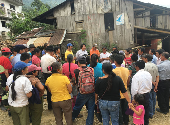
Nearby residents meet in July 2017 to discuss next steps after an on-site inspection with Ecuador’s National Security of Water.
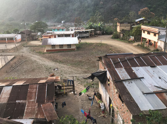
The small farming community of San Pablo de Amalí sits on the western slopes of the Andes.
Suspended
This community of unpaved roads, where hens and roosters outnumber people, had been fighting the facility since its first permit was approved in 2003, but their protests were met with violence and then deaf ears. Now that they have scientific results from UC Davis in hand, Ecuador’s water and human rights agencies are beginning to listen.
When it came time for Hidrotambo to reapply for its water concession in fall 2016, the community used the models to make a formal complaint to Ecuador’s National Secretary of Water (SENAGUA). Based on the UC Davis work, the water agency suspended Hidrotambo’s water concession and launched an in-depth investigation into the facility’s operation and its effects on upstream farmers and the aquatic life of the Dulcepamba River.
Based on the UC Davis work, the water agency suspended Hidrotambo’s water concession and launched an in-depth investigation.
This past May, UC Davis research engineer and the project’s principal investigator William Fleenor also met with the Inter-American Commission on Human Rights in Washington, D.C., to discuss the computer models. The commission is using the information to help decide what immediate actions need to occur for the communities’ safety. The commission will also take the analysis into consideration as it determines responsibility for damages and appropriate reparations.
“This is the kind of modeling that helps our own communities in the United States be protected from catastrophic floods,” Fleenor said.
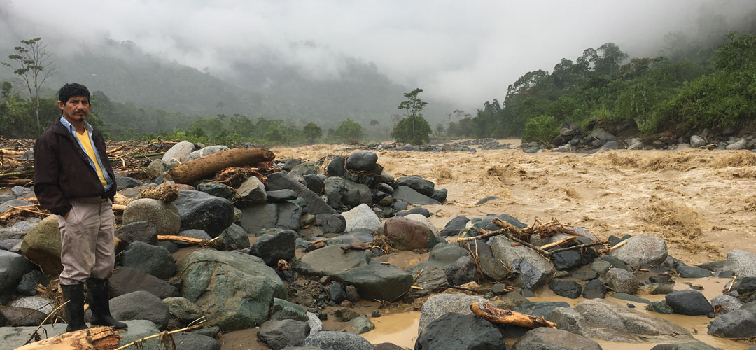
Manuel Trujillo, president of the Community of San Pablo de Amalí, stands by the Dulcepamba River in February 2017, after a second major flood affected the town.
In the absence of science
For the researchers involved in the project, it was a reminder of what happens when energy, water and other infrastructure projects move forward in the absence of science.
Run-of-the-river hydropower facilities are not inherently harmful. They generate electricity from the force of water flowing from a high elevation to a lower one using the river’s natural flow. Increasingly common throughout the world, these relatively small facilities are viewed as clean energy alternatives to fossil fuel power. But they require proper planning and scientific modeling before their installation to prevent disaster and loss of human life and property.
“The facilities themselves aren’t the issue, but the improper installation of them are,” said Jeanette Newmiller, a UC Davis graduate student who developed the model that showed how water moves through the river. “To me this is a modern check of why we need sound science to better inform projects like this. We have an opportunity to do it right.”
The results indicate the company is also unlikely to produce the amount of energy it initially expected when it made the investment.
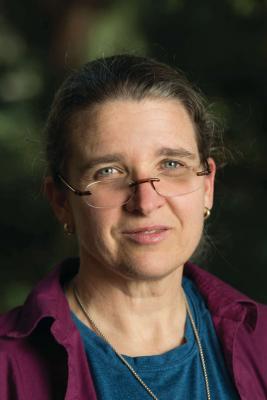
Jeanette Newmiller
Karin Higgins / UC Davis
Water without borders
“This kind of thing happens all over the world, including in the United States,” said Nicholas Pinter, a flood expert and UC Davis professor of earth and planetary sciences who connected Conrad with UC Davis researchers. “In poor areas, with a lack of homegrown scientific knowledge and expertise, those communities fall victim to powerful outsiders.”
Even when countries have strong regulations and water laws on the books, they often lack the resources, technology and expertise to carry them out. UC Davis researchers used freely available software to conduct their water modeling. Such software could help countries and municipalities without many financial resources conduct modeling before constructing similar projects.
The work in Ecuador represents a broader effort by the Center for Watershed Sciences to establish a World Water Initiative, which could include a rapid-response capability to provide water-science expertise to underserved populations like San Pablo de Amalí around the world.
“We’re definitely a collaborative group,” Fleenor said. “That’s what you have to have to tackle a problem. At the center, we’re not just here for the science and research, but to supply the information to policymakers so they can make these policy decisions.”
“To me this is a modern check of why we need sound science to better inform projects like this. We have an opportunity to do it right.”
—Jeanette Newmiller, UC Davis graduate student
In their hearts
In Ecuador, Conrad said that for the first time in more than a decade, the residents of San Pablo de Amalí are hesitantly hopeful.
“The community knew in their hearts and from experience that there’s no way the river had that much water in it,” Conrad said. “But the scientific results from UC Davis really legitimized their complaints. I also don’t think the Inter-American Commission would have taken the case as seriously without the data and subject matter experts to explain why the road was taken out, why houses were lost, why people died.”